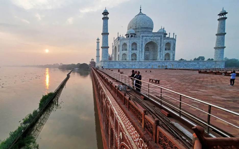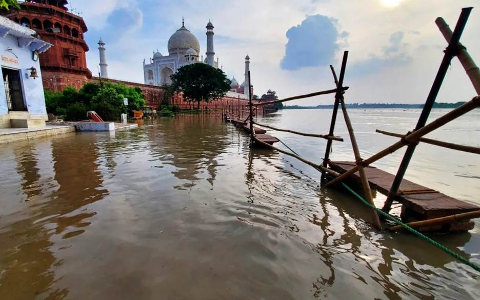
One of the Taj Mahal's gardens was submerged by the flooding - Pawan Sharma/AFP
Flood Waters Reach Walls of Taj Mahal for First Time in 45 Years
By Samaan Lateef Flood waters have touched the walls of the Taj Mahal for the first time in more than four decades as heavy rains continue in India .
A rise in the Yamuna River, which runs alongside the World Heritage site in the northern city of Agra, submerged one of the monument’s gardens and saw water press against its rear-side, river-facing walls.
The Yamuna’s water level, which has swelled from recent downpours, has reached 498 ft, crossing the “low-flood level” of 495 ft, said officials.
However, officials said that the main section of the Taj Mahal was safe.
Prince Vajpayee, a conservation assistant at the Archaeology Survey of India, said that the Taj Mahal’s design meant that water would not be able enter its main mausoleum, even during high floods.
The monument’s foundations are also reported to be safe, having been built to withstand flooding with the use of a special water-resistant mortar called Sarooj.
The last time flood water spilling out of the Yamuna touched the back wall of the Taj Mahal was in 1978, when the river’s level soared to 508 ft, Mr Vajpayee said.
“Following the 1978 flood, a garden behind the Taj Mahal was developed, creating a buffer area,” he said.

The foundations of the Taj Mahal were built with a water-resistant mortar called Sarooj to protect it from being damaged by flooding - Pawan Sharma/AFP
The latest breach took place as parts of northern India were flooded, including the capital, New Delhi, which killed scores of people and forced tens of thousands of others to evacuate their homes.
States such as Haryana, Punjab, Gujarat, Himachal Pradesh and Rajasthan have received nearly double their normal rainfall so far this season.
On Tuesday, officials said that flash floods in the northeastern Assam state had killed at least eight people and displaced more than 115,000 after a regional river burst its banks earlier this month following heavy monsoon rains.
Water from the swollen Brahmaputra River has engulfed nearly 450 villages in 17 districts in the hilly state in northeastern India, inundating large swathes of wildlife sanctuaries as well, officials have said.
The India Meteorological Department meanwhile predicted light to moderate rain in Himachal Pradesh, the worst-hit Indian state, which has experienced more than 40 flash floods in recent weeks.
At least 122 people have been killed in the northern state, which sits in the mountainous Himalaya region, since the onset of the monsoon season on June 24.
Typhoon Talim
The developments came as Typhoon Talim reached Vietnam on Tuesday after passing through China less forcefully than feared, with no deaths reported in either country despite hundreds of thousands of people evacuating before the storm hit.
Talim first made landfall in southern China late on Monday evening, battering the coast of Guangdong province with winds of 136.8 kph (85mph).
On Chinese social media, videos showed pedestrians falling over and struggling against the winds and flooded roads.
Xinhua, China’s state news agency, said that nearly 230,000 people were evacuated from their homes in the southeastern region before the storm hit.
Overnight, the storm moved into Beibu Gulf in the South China Sea, and, by early Tuesday, it had made a second landfall and moved into the southern Guangxi region.
Wind speeds had fallen to 90 kph (56 mph) near Talim’s center, as of 8am local time, China’s meteorological administration said.
The storm is expected to weaken and dissipate further as it moves northwesterly into northern Vietnam later on Tuesday, the administration said. - The Telegraph

