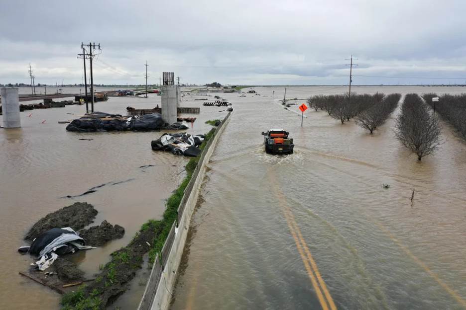

A truck drives across a flooded road near Corcoran, California - Patrick T. Fallon / AFP via Getty Images file
California Is Dangerously Saturated after 12 Monstrous Storms, and More Water Is Coming
By Kathryn Prociv and Evan Bush
Battered by a seemingly endless string of damaging storms, California this week endured what was perhaps the most ferocious tempest yet this season — the state’s 12th atmospheric river storm since Christmas.
On Tuesday, a bomb cyclone hammered the Bay Area with hurricane-strength winds. The Federal Aviation Administration implemented ground stops at Oakland International Airport and San Francisco International Airport as gusts exceeded 60 mph. In the Santa Cruz mountains, winds reached 89 mph.
“This was a violent, sudden wind storm,” said Daniel Swain, a climate scientist at UCLA and the National Center for Atmospheric Research, during a briefing on storm impacts .
Then, the storm shifted south, drenching Southern California with heavy rainfall and touching off a tornado in a small city northwest of Los Angeles that damaged about 25 mobile homes, according to the National Weather Service .
On Wednesday, the storm lingered over Southern California, sending a second tornado swirling through Montebello, just east of Los Angeles. Rated a 110 mph EF1 tornado , it was the strongest to strike in the Los Angeles metro since 1983. At least five people died during these storms , according to the Associated Press.
After three years of drought, California has seen a record-setting deluge that seemingly won’t quit. Rainfall once viewed as a needed blessing has become a hazard for many communities now fighting to stay above water. The series of storms have killed dozens, closed roadways with mudslides and avalanches, filled bone-dry reservoirs, strained levees and flooded communities.
The dramatic impacts from these storms show how impactful atmospheric river systems can be for California and also reveal how dramatically the weather can swing in the Golden State, which has a temperamental climate that can produce both extreme wet and dry conditions.
And even more water is on the way. The state now boasts its largest snowpack in decades, after years of extreme drought that weakened levees and drew attention away from flood management. Now, those levees will contend with what should be the largest spring runoff in decades.
The most recent storm arrived on the heels of 11 other atmospheric river-fueled storms that have dropped trillions of gallons of water on the state since the start of the new year. Atmospheric rivers are plumes of tropical moisture that stretch thousands of miles across the Pacific Ocean.
Atmospheric rivers often drive extreme weather in California and other Western states. They cause more than $1 billion in yearly flood damage on average and about 84% of flood damage in Western states, according to research published last year in Scientific Reports. Climate change is expected to exacerbate atmospheric river impacts in the future because a warmer atmosphere can absorb and transport more water vapor.
During the most recent storm, attention centered on wind damage. But many communities are now nervously eyeing local mountain ranges, which have historic snowpacks.
Storm systems fueled by atmospheric rivers are typically very wet and warm. In California, they often produce heavy rain and raise snow levels in the Sierra Nevada mountains. This can create a recipe for disaster as rain falls on snow, which can saturate the snowpack or lead to rapid snow melt.

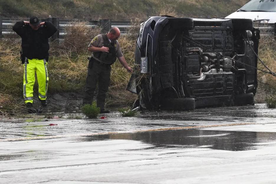
Emergency personnel look at a vehicle that flipped during a storm - Patrick T. Fallon / AFP via Getty Images
The spring melt-out could be extreme. Statewide, California has more than twice as much snow stored in the mountains as average for this time of year.
A series of exceptionally cold storms in February dropped feet of snow over portions of the Sierra, especially the central and southern regions. The storms even prompted rare blizzard warnings for lower elevations across Southern California. On February 23, the National Weather Service in San Diego was forced to issue its first Blizzard Warning on record for the San Bernardino Mountains. This was just one day after the National Weather Service office in Los Angeles issued their first Blizzard Warning since 1989. This was for areas just 10 miles outside of downtown, as flakes flew over the iconic Hollywood sign.
As of Thursday, the Central Sierra Snow Lab was up to just over 690 inches for the season. That is the second highest total on record, beating out the benchmark season of 1982-1983 season. The top mark is 812 inches, a record established in 1952.
While all of this rain and snow has done wonders to wipe away drought conditions, fill reservoirs and fuel wildflower super blooms, there is a looming danger going into April and May.
The recent heavy rainfall combined with Sierra snowmelt could set up a dangerous risk of flooding for communities downhill of the mountains and located in the Central Valley and especially San Joaquin Valley of California.
In its Spring Outlook , the National Oceanic and Atmospheric Administration said there is a heightened risk for flooding across portions of central California, including the Central Valley and San Joaquin River Valley.
“California’s historic snowpack, coupled with spring rain, is heightening the potential for spring floods,” said Ed Clark, director of NOAA’s National Water Center.
In some areas, it’s already begun.
In the Tulare basin, floodwaters have already begun to fill farmers’ fields and spill into local communities. Farmland near Corcoran — near the historic Tulare Lake — has been dubbed “The Corcoran Sea .” Drone shots from the area show farmhouses surrounded by brown floodwaters.
The Tulare Lake, which is a dry lake bed now used for agriculture, could re-emerge after the incredible precipitation. The lake last had water in 1997 and before that 1983, both benchmark years in terms of rainfall and Sierra snow amounts.
Local communities are fighting floodwaters.
“Our community is completely surrounded by water right now,” said Kayode Kadara, a resident of Allensworth and a community organizer. Kadara, said about one-third of Allensworth is underwater and many of its 600 residents have been forced to leave.
“We are all nervous. The challenge of melting snow from the mountains is not something we are taking for granted at this point,” Kadara said, saying he expected the threat to last for several months.
This article was originally published on NBCNews.com

