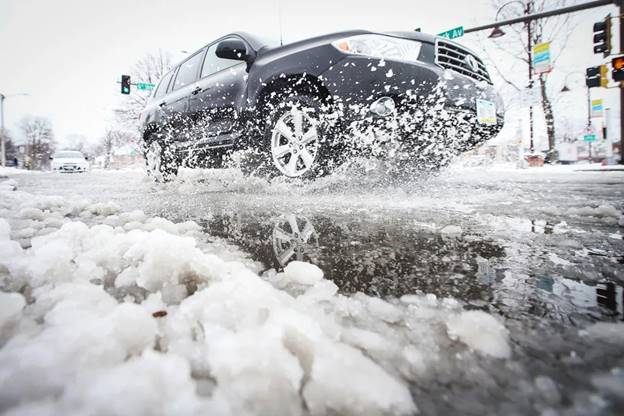
A car passes through snow on Clark Avenue after a snowstorm - Nirmalendu Majumdar / USA Today Network
Major Winter Storm to Bring Rain and Snow from West Coast to Plains
By Mirna Alsharif and Christine Rapp
A high-impact winter storm is forecast to bring rain and snow to an area spanning from California through the northern Plains to Michigan’s Upper Peninsula.
About 14 million people are under winter weather alerts Sunday, including in Tahoe, California; Denver; Minneapolis; and Sioux Falls, South Dakota.
More than 12 inches of snow had already accumulated in Alta, Utah, as of Sunday morning, while 7.3 inches of snow had fallen in Flagstaff, Arizona.
Heavy snow will continue to develop over the central and northern Plains on Sunday afternoon, with blizzard conditions that will create hazardous travel conditions overnight, affecting parts of Colorado to Minnesota. A dangerous combination of 2 inches per hour of snowfall and 60 mph wind gusts is possible.
“Strong winds and heavy, wet snow on trees and power lines may damage trees and cause power outages,” the National Weather Service said in an update Sunday. “Wind gusts over 50 mph today may result in power outages, blowing dust with reduced visibility, difficult travel and property damage.”
Steady snow showers will persist through Monday, with snow clearing out and into Canada by Tuesday evening. The area from Nebraska to northern Wisconsin will likely see about 8 to 16 inches of snow, with some areas receiving up to 20 inches.
This same storm system will also spark heavy rain and severe weather concerns across the southern Plains and Southeast through the next two days.
On Sunday, the storm is forecast to target Kansas and Oklahoma, including Wichita and Dodge City. Storms this afternoon and overnight will be capable of producing very large hail, tornadoes and damaging wind gusts.
By Monday, this risk will shift into east Texas and the lower Mississippi Valley, affecting 7 million in Louisiana, including New Orleans, Baton Rouge and Shreveport. Damaging wind gusts will be the primary concern with any storms that form Monday afternoon and evening, with a few tornadoes possible.
Localized flash flooding may also occur across the South including in Missouri, Arkansas, Mississippi and Alabama, where rainfall totals through Tuesday will range from 1 to 3 inches, and locally up to 4 inches.
Over the weekend, a powerful weather system a ffected the tri-state area with heavy rain and strong winds, as a fast-moving storm blanketed northern New England with snow.
Snowfall totals as of Saturday evening included 24.5 inches in Landgrove, Vermont, 20.5 inches in both Corinth, New York, and Claremont, New Hampshire, and 13.5 inches in Sweden, Maine, according to the National Weather Service.
On Sunday, weather in the tri-state area is expected to be breezy, with wind gusts of over 30 mph forecast, according to the National Weather Service field office in New York.
This article was originally published on NBCNews.com

